
Typhoon SaudeL Path Forecast: Strong Winds Expected Starting This Afternoon
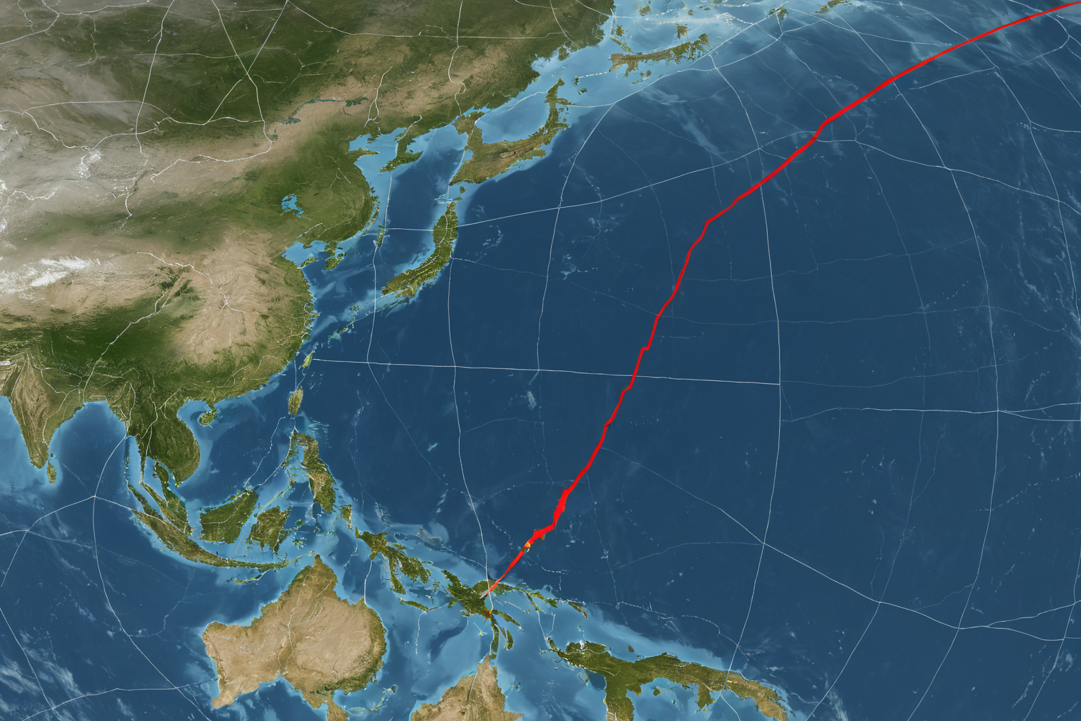
Typhoon SaudeL Path and Forecast
Typhoon 'SaudeL' (No. 18) is intensifying over the South China Sea and expected to move northward. The Korea Meteorological Administration (KMA) and models like ECMWF and GFS have adjusted their path predictions, raising concerns about potential impact on the Korean Peninsula.
Latest Status of Typhoon SaudeL
Typhoon 'SaudeL' is strengthening as it moves through the South China Sea, with showers, gusts, thunderstorms expected nationwide from tomorrow to the day after. The KMA has urged caution regarding potential impact on the Korean Peninsula due to the typhoon's northward movement.
Specifically, strong winds are anticipated to begin this afternoon based on the projected path of Typhoon No. 18 SaudeL. Showers, gusts, and thunderstorms are forecast across the country, a phenomenon attributed to atmospheric instability.
Changes in Typhoon SaudeL's Path
The typhoon's path has been adjusted differently by various models. Initially, ECMWF and GFS shifted the track westward but later revised it northward, increasing the likelihood of impact on the Korean Peninsula.
The KMA announced the path for Typhoon No. 18 SaudeL on August 19, 2026, followed by additional forecasts of nationwide showers due to strong winds on August 20. On August 21 and 22, the path was adjusted westward and then northward, with increasing reports about potential impact on the Korean Peninsula.
Notably, on August 24, 2026, the typhoon's projected path shifted up to 1.1 degrees northward, according to forecasts. This adjustment appears to be a result of coordination between the KMA and forecasting models.
Intensity Changes
Typhoon 'SaudeL' is strengthening as it moves northwest, with its intensity expected to rise to 'Strong' by August 22, 2026. Both the KMA and models like ECMWF and GFS have assessed it as 'Very Strong.'
Previously, SaudeL had grown into a super-strong typhoon, moving along China's coast. Some reports mistakenly suggested it was approaching Vietnam and would weaken to a tropical depression within a day, but this appears to be confusion with another typhoon named Lagasa.
Potential Affected Areas
Due to the low-pressure system near South Korea's southern coast, showers are expected as a result of atmospheric instability. Nationwide, showers, gusts, and thunderstorms have been forecasted.
Typhoon SaudeL is moving northward toward Okinawa, with heightened attention required regarding potential impact on the Korean Peninsula. The KMA will continue to monitor the typhoon's path and update forecasts accordingly.
Some reports indicate that the typhoon's effects may begin to be felt nationwide from August 22, 2026, as it moves northwest toward the Korean Peninsula.
Comparison of Typhoon Forecast Models
ECMWF and GFS models have been adjusting SaudeL's path differently. ECMWF initially shifted westward, while GFS moved northward, but both later revised their paths northward, increasing the likelihood of impact on the Korean Peninsula.
This discrepancy in forecasts reflects uncertainty about the typhoon's path. The KMA is preparing real-time response measures based on these changing predictions.
Key Information About Typhoons
Information about Typhoon No. 17 Mitak and Typhoon No. 18 Lagasa is also provided, but some reports mistakenly refer to 'Lagasa' instead of 'SaudeL,' causing confusion.
For example, a report dated August 17, 2026, mentioned 'Typhoon No. 18 Lagasa,' while other sources reported it as 'SaudeL.' This appears to be an error due to confusion with another typhoon's name.
Projected Path and Cities
Specific details about the exact cities along Typhoon SaudeL's projected path are currently limited. Some reports suggest it is moving toward Okinawa, but no specific city names have been mentioned.
Whether the typhoon will directly affect the Korean Peninsula remains uncertain. The KMA states that as the typhoon moves northward closer to the peninsula, the likelihood of impact increases.
Preparation and Safety Information
The KMA is monitoring strong winds and rain caused by Typhoon SaudeL's northward movement, urging caution in areas forecasted for showers, gusts, and thunderstorms.
Strong winds are expected to begin this afternoon, so it is advisable to avoid outdoor activities and seek shelter indoors. Additionally, precautions should be taken against flooding and road congestion due to heavy rainfall.
Information to Verify
The exact cities along Typhoon SaudeL's projected path and whether it will directly impact the Korean Peninsula remain unconfirmed. Further updates from the KMA and relevant authorities are awaited.
Frequently Asked Questions
How long will Typhoon SaudeL last?
Strong winds and rain from Typhoon 'SaudeL' (No. 18) are expected to continue until the day after tomorrow, with potential for increased impact as it moves closer to the Korean Peninsula.
Will Typhoon SaudeL directly affect the Korean Peninsula?
The likelihood of impact on the Korean Peninsula has increased due to revised path forecasts by the KMA and models, but specific city-level impacts remain unconfirmed.
Why is there confusion between 'Lagasa' and 'SaudeL'?
Some reports incorrectly listed the typhoon's name as 'Lagasa,' causing confusion with another typhoon. This appears to be a reporting error.
Frequently Asked Questions
Typhoon No. 18 SaudeL is intensifying over the South China Sea and expected to move northward, with path adjustments by the KMA and models increasing potential impact on the Korean Peninsula. However, exact city-level paths and direct effects remain unconfirmed.
Nationwide areas forecasted for showers, gusts, and thunderstorms should exercise caution, as these are atmospheric instability-related phenomena that can change rapidly. It is recommended to monitor the latest updates from official sources.
You can view more articles on similar topics in one place.
View Related ArticlesFAQ
How long will Typhoon SaudeL last?
Strong winds and rain from Typhoon 'SaudeL' (No. 18) are expected to continue until the day after tomorrow, with potential for increased impact as it moves closer to the Korean Peninsula.
Will Typhoon SaudeL directly affect the Korean Peninsula?
The likelihood of impact on the Korean Peninsula has increased due to revised path forecasts by the KMA and models, but specific city-level impacts remain unconfirmed.
Why is there confusion between 'Lagasa' and 'SaudeL'?
Some reports incorrectly listed the typhoon's name as 'Lagasa,' causing confusion with another typhoon. This appears to be a reporting error.
Korean Source
This article is an English localization of a Korean-language report from BlogScore. Original: 18호 태풍 경로 예상: 오늘 오후부터 강풍 시작, 주의 필요