
Iberian Peninsula: Where Geography and Climate Divide on the Map
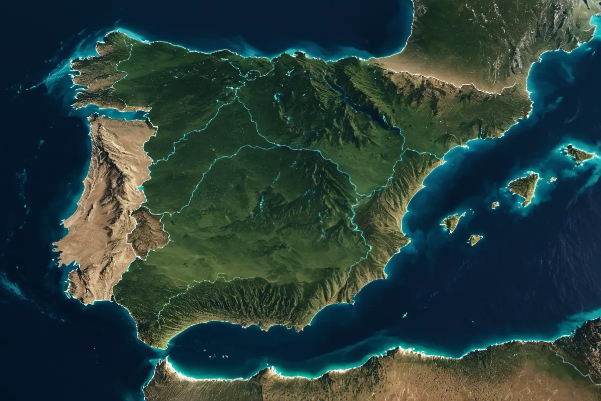
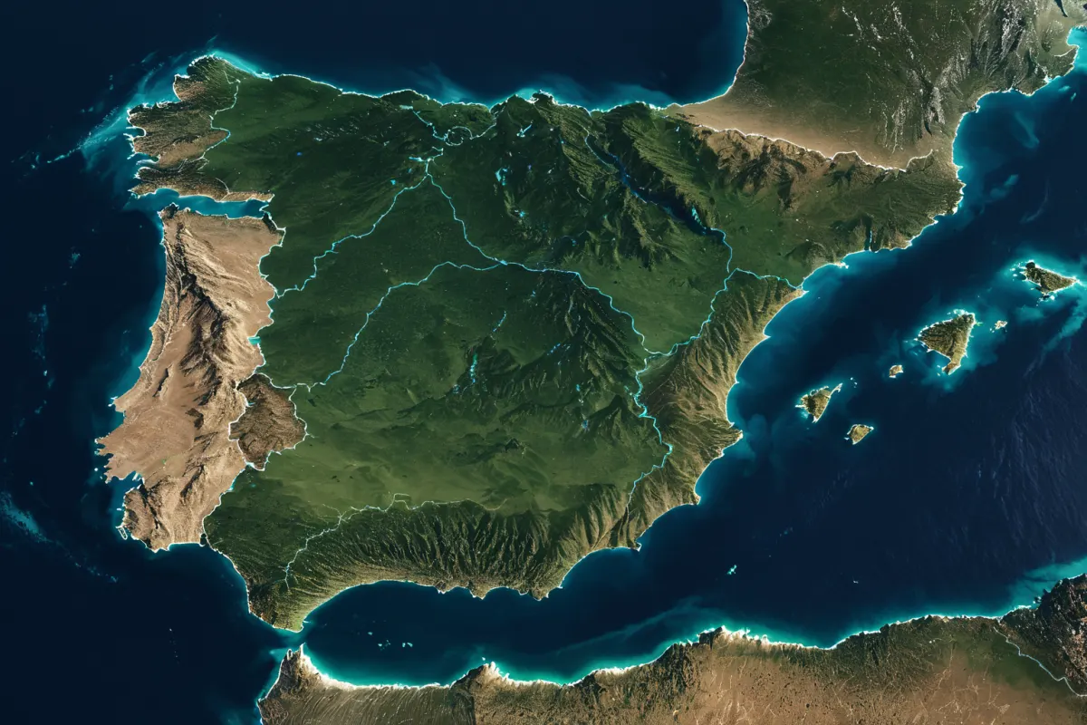
The Iberian Peninsula is a large peninsula located at the southwestern tip of Europe, with most of it occupied by Spain and Portugal. While it may appear as two countries on a map, the region is actually divided by mountain ranges that influence climate patterns and coastal lines that shape travel routes. Understanding the terrain first makes navigating this area much easier.
Especially when looking at an Iberian Peninsula map, you need to consider how the northern mountains, central plateau, and eastern and western coastlines create distinct atmospheres. Even within the same peninsula, some areas are rainy while others are dry, affecting everything from city histories and cuisine to travel times.
Key Landmarks on an Iberian Peninsula Map
The Iberian Peninsula sits between the Atlantic Ocean and the Mediterranean Sea. To the north lies France and the Pyrenees Mountains, the west opens toward the Atlantic Ocean, and to the south is the Strait of Gibraltar facing Africa.
While Spain and Portugal may look like a single block on a map, actual travel routes span much more than you might expect. Cities like Barcelona, Madrid, Seville, and Lisbon have very different characteristics, so when planning trips, consider not just distance but also rail or domestic flight connections.
You can find more articles on similar topics in one place.
View Related ArticlesThe Core Geography of the Iberian Peninsula
When understanding this region’s geography, the first thing to notice is its mountain ranges. The Pyrenees form the northeastern border, while the Cantabrian Mountains run along the northern coast. In the center lies the vast Meseta plateau.
This plateau makes the interior higher and drier compared to coastal areas. For instance, Madrid sits on an inland plateau, so summers can be hot and winters relatively cool. Meanwhile, the northern coast experiences lush greenery and frequent rain due to Atlantic influence.
Mountains and plateaus aren’t just geographical features—they define city identities. Northern regions feature pastoral landscapes and port cities, while southern and inland areas showcase plains, dry zones, and historic cities.
Why Climate Differs Across the Iberian Peninsula
Climate differences arise from the combined effects of mountains and sea. The north has a mild, wet Atlantic climate, while the southeast features a dry, sunny Mediterranean climate. The central plateau mixes continental traits with larger temperature swings.
This variation matters greatly for travelers. Even during the same season, cities like Santiago de Compostela and Seville feel different, as do Barcelona and Bilbao in terms of weather. Looking at north-south contrasts on a map clarifies why clothing choices differ across regions.
For example, May in Lisbon, Portugal, brings pleasant, cool days ideal for walking, while inland Andalusia can feel quite warm during midday. Conversely, winters bring cold winds to the plateau interior, but milder conditions along the coast.
How Mountain Ranges Shape Travel Routes
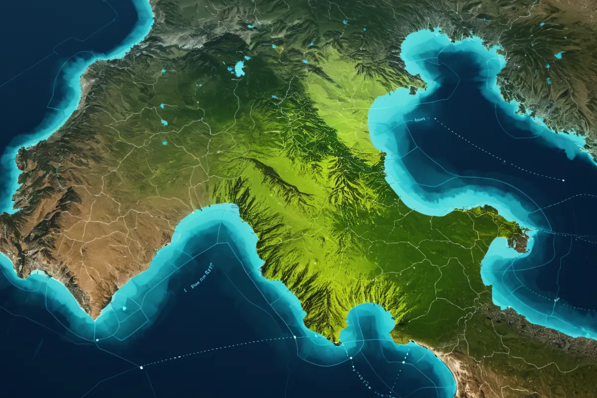
The mountain ranges of the Iberian Peninsula aren’t just scenery—they act as physical barriers affecting travel. Major north-south mountain chains limit where railways and roads can pass, often making travel times longer than map distances suggest.
For instance, moving from coastal cities to inland ones requires more winding routes than direct lines would indicate. So for short trips, it’s better to choose cities with good transport connections rather than those that look close on a map.
This geography also shaped historical events and conflicts. Mountains and plateaus restricted external invasions, helping preserve unique regional cultures and defensive strongholds over centuries.
Historical Influence of Islamic Culture
A notable feature in Iberian history is the lasting influence of Islamic culture. During the Middle Ages, this region was a battleground for various powers, leaving traces in architecture, urban layouts, and language loanwords that remain today.
Landmarks like Granada’s Alhambra showcase deep Islamic artistic influence—a major attraction for travelers. While maps show distances between cities, each city carries distinct historical layers, making travel itineraries feel very different in density and character.
Though Spain and Portugal share the peninsula, their histories unfolded differently. So while they can be grouped as Iberian nations, detailed trip planning should account for how each country’s historic centers and coastal cultures develop separately.
Mistakes Travelers Often Miss on Maps
A common oversight when first studying a map is elevation. Flat-looking maps may suggest smooth terrain, but the region has many plateaus and mountains, making city-to-city travel more complex than expected. Whether traveling by car or train, checking routes in advance ensures smoother journeys.
Another mistake is ignoring seasonal temperature differences. Traveling along the coast in summer is relatively easy, but combining inland and southern areas can mean dealing with intense heat. Conversely, winter travel requires considering rain and wind on northern coasts.
For example, splitting your trip into Barcelona (2 days), Madrid (2 days), Seville (2 days) might not be ideal. Instead, grouping cities by climate zones—like Barcelona-Valencia-Granada—or focusing solely on the northern coast reduces travel strain. Learning to read climate lines on maps is key.
Travel Tips for Iberian Peninsula Preparation
When preparing for a trip, don’t just rely on map apps; consider mountain ranges, coasts, and elevation differences too. Walking tours, car rentals, and intercity train travel all have varying levels of difficulty based on terrain.
In short: the north offers greenery and rain, the center features plateaus and temperature swings, and the south provides sun and dryness. Using these three elements to plan your clothing, itinerary, and accommodation locations makes for a much smoother trip. Even within the same peninsula, morning and afternoon atmospheres can differ greatly by region.
Viewing an Iberian Peninsula map as a tool to understand regional character—not just travel information—helps travelers remember places better. Knowing where it’s hot, humid, or difficult to move between cities makes city names more meaningful in memory.
FAQ
Q1. Which countries does the Iberian Peninsula include?
The peninsula primarily includes Spain and Portugal, though Gibraltar at the southern tip is also geographically part of it.
Q2. When is the easiest time to travel on the Iberian Peninsula?
Spring and autumn are generally mild for travel. However, weather varies significantly between north and south, so your experience will depend on where you’re visiting.
Q3. What should I focus on when studying an Iberian Peninsula map?
Instead of borders, look at mountain ranges, plateaus, coastlines, and distances between major cities. Understanding the terrain first helps grasp climate patterns and travel routes together.
Travel conditions vary by season and location, so double-checking weather and transport updates just before departure is recommended.
Continue exploring similar topics.
View Category ArticlesFAQ
Which countries does the Iberian Peninsula include?
The peninsula primarily includes Spain and Portugal, though Gibraltar at the southern tip is also geographically part of it.
When is the easiest time to travel on the Iberian Peninsula?
Spring and autumn are generally mild for travel. However, weather varies significantly between north and south, so your experience will depend on where you're visiting.
What should I focus on when studying an Iberian Peninsula map?
Instead of borders, look at mountain ranges, plateaus, coastlines, and distances between major cities. Understanding the terrain first helps grasp climate patterns and travel routes together.
Korean Source
This article is an English localization of a Korean-language report from BlogScore. Original: 이베리아 반도: 지도에서 보는 지형과 기후가 갈라지는 지점